

When drone mapping and the gaming world come together
We constantly hear about drones being used in construction, film and real estate but the latest innovative and exciting use is in the $100billion industry of ‘digital videogames’. Yes- that’s right, this includes games for consoles such as PlayStation, Nintendo, Xbox, PC and even mobile Apps!
“Digital videogames is said to pass the $100 Billion revenue checkpoint by the end of this year (2017)” According to Juniper Research published by CNBC
We all know games are getting more and more realistic due to new technological advancements such as improvements in hardware and software but we are also seeing innovative ways of acquiring imagery such as the use of drones.
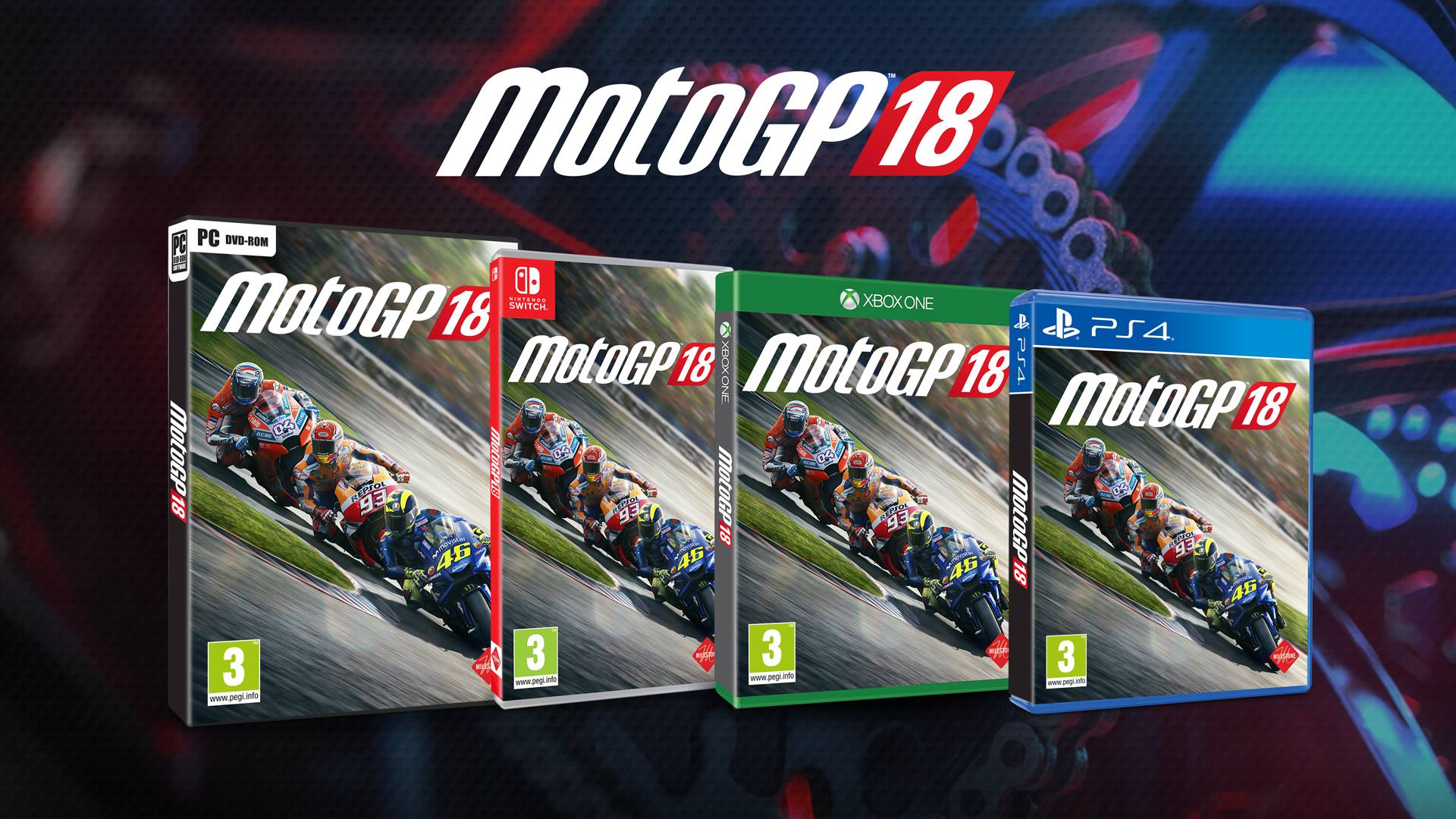
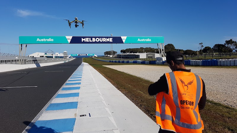
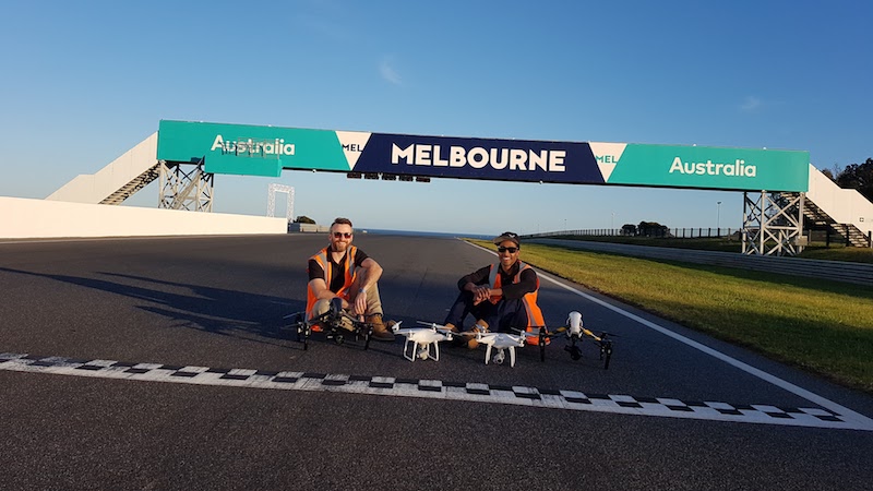
UAVisuals worked with one of the leading gaming companies Milestone to help in their production of the latest MotoGP video game release.
It took 4 drones in total (2x Phantom 4 Pros & 2x Inspire Pros), a boot full of batteries and a big checklist to go through all the shots required for the build.

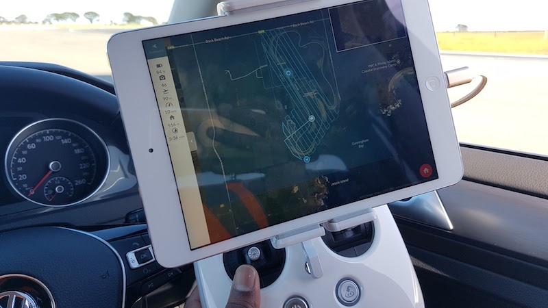
Two DJI Inspires & batteries in the back of the car
The main use of the drone prior to the game build was photogrammetry/ mapping but also to identify textures of the track and its surroundings.
Textures & Transitions
Details and the determination of obtaining the true colour of the grass, curb, vegetation, tarmac, skid marks etc were all identified using a colour checker and a visual reference such as a ruler. The shots were taken at various altitudes starting around 1 meter getting the finer details & colour followed by higher shots at 20 meters to grasp the transitions and interactions of the textures.
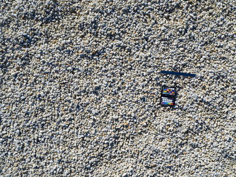
Getting textures of the gravel referencing colour and size

Higher altitude- referencing Paul (laying around on the job) & the car
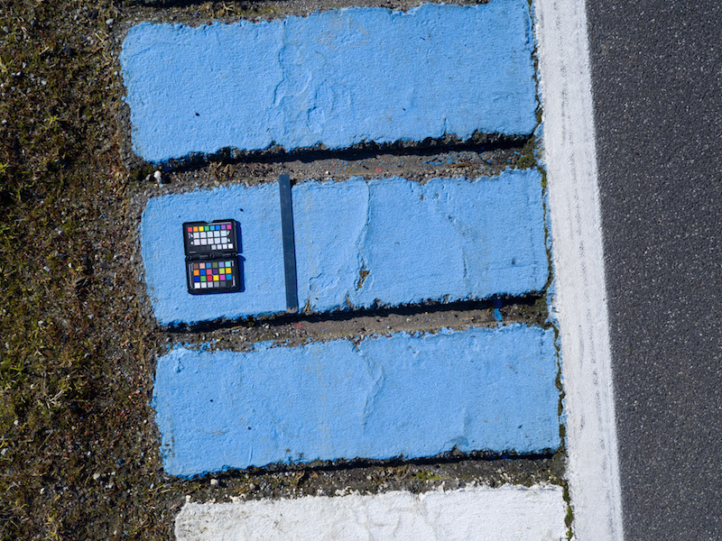
Colour checker & ruler against the curb
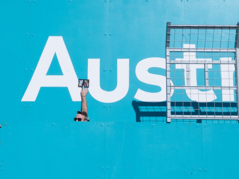
Paul with the colour checker making sure we get the right blue!
Aerial Photogrammetry
Drone photogrammetry is the science of obtaining geometric measurements from objects using photos. Applications of photogrammetry include survey and mapping products such as orthophotography, digital elevation models, and more recently 3D models.
Using a pre-programmed flight of the track, the drone sets out to take photos every few meters with 65% overlap, enabling us to confidently blanket the whole site with geo-referenced images. These images are then stitched together by drone mapping app, Drone Deploy to create a high resolution & extremely accurate survey of the site.
Drone Deploy app used for the track survey
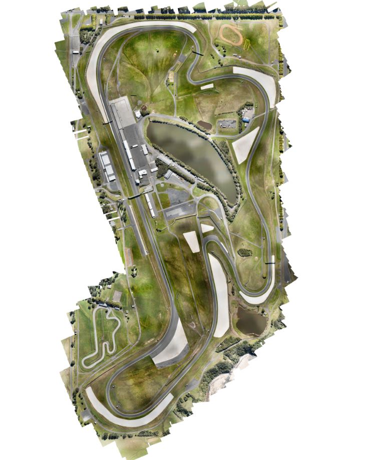
3d drone scan of Phillip Island
3D renders
3D models produced with photogrammetry techniques are usually at the least, human-sized objects, very realistic and contain details which would be challenging and time-consuming for a 3D artist to recreate.
The paddock area was surveyed by another drone mapping software called Altizure. This software also sends the drone on an automated path, this time completing 5 runs covering the paddock with multiple passes and camera angles to reproduce a 3D visual representation.
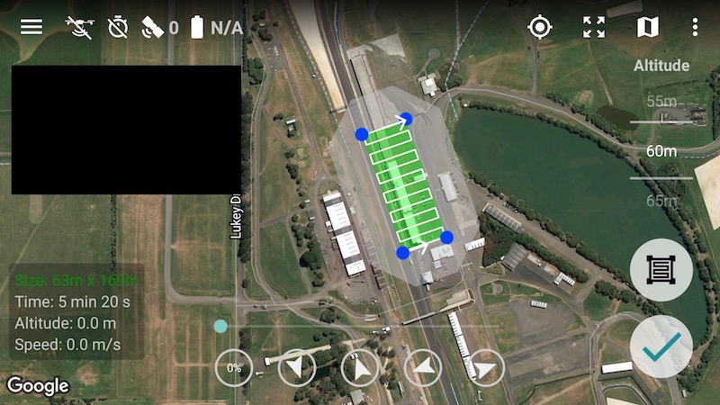
Altizure drone app, pre-programmed flight path over the Paddock area
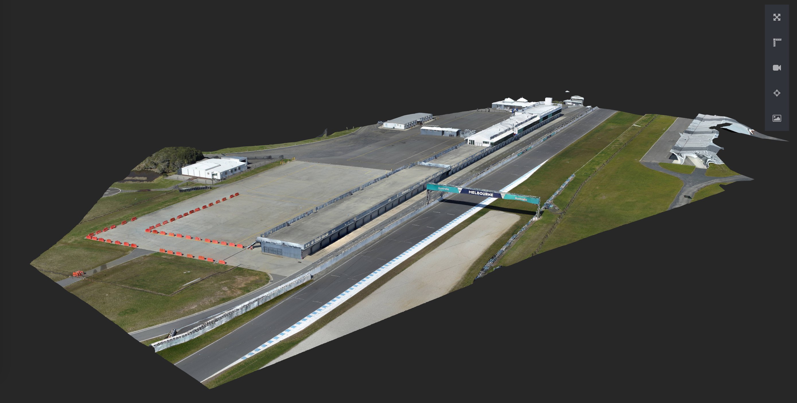
3D rendered view of the paddock area
Photography & Video
We also used general drone & DSLR photography/ video of the track, sky, sun, clouds to get an idea of the extra details for the external graphics.
Aaron capturing 4K video of the track and details
Job done!
All up it was a success, next step is to buy ourselves the game and race!
More information see our commercial services or contact: info@uavisuals.com
Client:
Milestone
MotoGP Video Game
Drone Photogrammetry:
UAVisuals