
Drone Mapping & Surveying
Construction | Environment | LiDAR | VFX
UAVISUALS offers professional Lidar, Mapping & Photogrammetry services for design and reporting. Utilising the latest in drone technology, our experienced pilots capture high-resolution aerial imagery and topographic data with pinpoint accuracy.
Our drone surveying and mapping services provide cost-effective and efficient solutions for land surveying, environmental monitoring, construction site monitoring, and more. From creating 3D models to generating topographic maps, our services help clients make informed decisions with actionable insights. Whether you need to survey a large area or inspect a specific site, our drone surveying and mapping services are a reliable and efficient solution.
Photogrammetry
3D modeling & Mapping
Our drones are equipped with advanced RTK capabilities allowing us to create high-resolution 3D models, digital terrain models, and orthomosaic maps with mm accuracy.
Our photogrammetry services are ideal for a variety of industries, including construction, power, surveying, and agriculture.
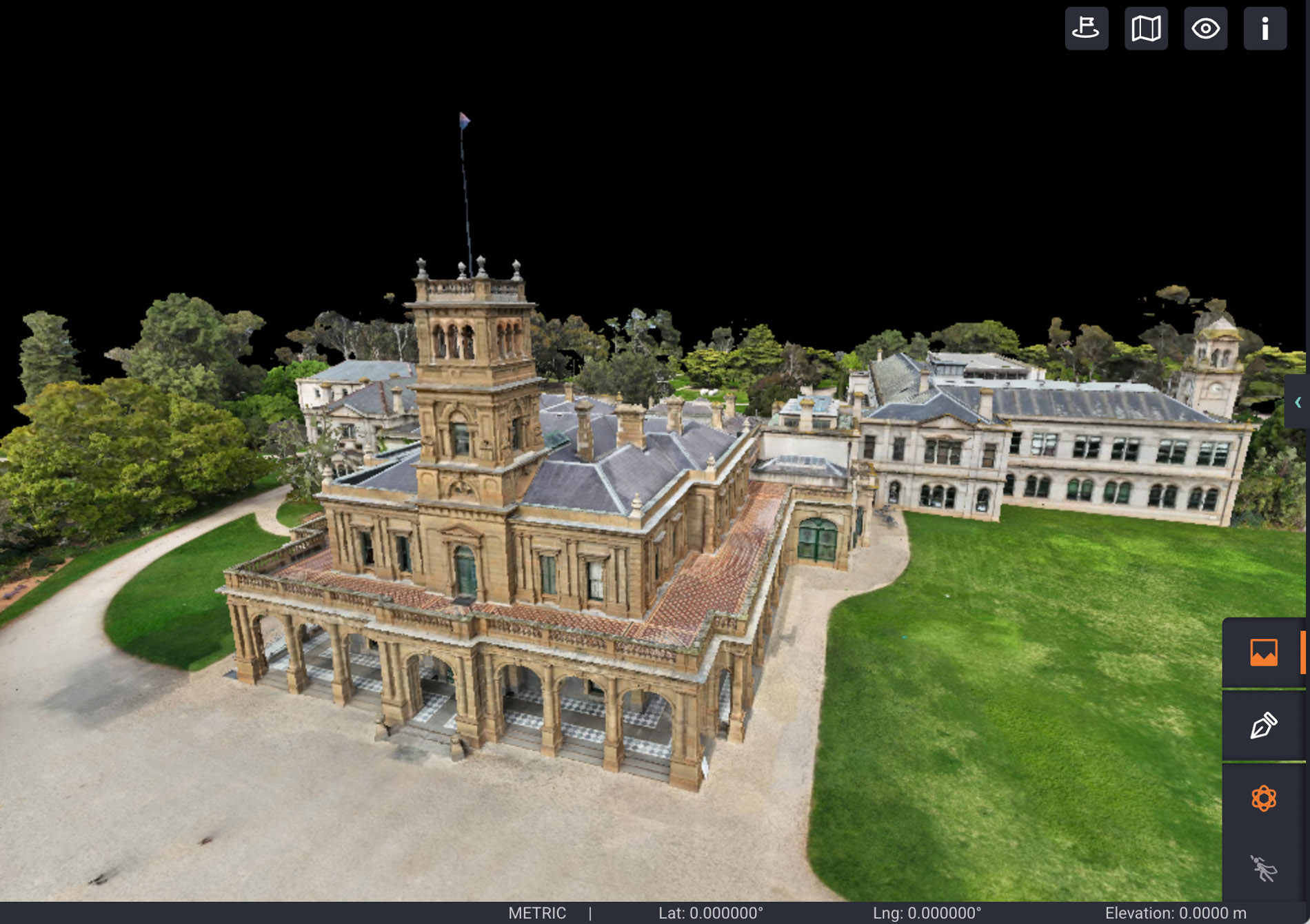
3D Model: Werribee Mansion
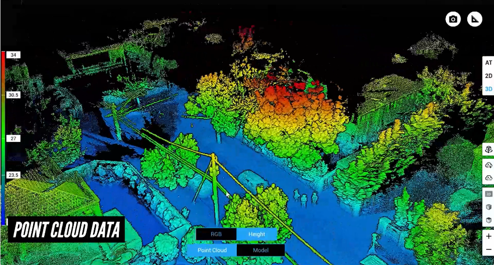
LiDAR
Aerial laser scanning
LiDAR (Light, Detection, and Ranging) is a survey technique that uses laser technology. LiDAR works by emitting light waves that bounce off objects and are reflected back. The resulting data, collected from multiple laser pulses, is processed into a 3D image referred to as a point cloud.
LiDAR maps can also be used to highlight changes and abnormalities such as surface degradation, slope changes and vegetation growth.
We are dedicated problem solvers, offering innovative solutions to tackle your toughest challenges
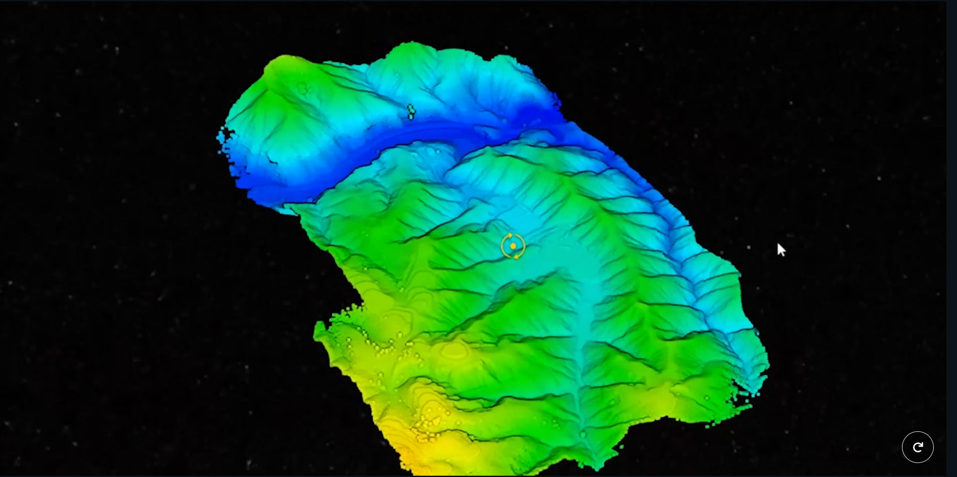
Digital Terrain Models
Slopes and topography
Digital terrain or surface modeling is the process of creating a digital representation of the topography of a specific geographic area.
This involves the collection of elevation data, usually through techniques such as LiDAR (Light Detection and Ranging), aerial photography, or satellite imagery. The data is then processed and used to generate a 3D model of the terrain, which can be used for a variety of applications such as environmental analysis, urban planning, and the design of infrastructure projects
Obtaining terrain information from a drone scan