Industrial Inspections, Construction Surveying, and Asset Security
Commercial Drone Services
“Until recently, surveying, inspecting, and mapping assets were costly and inefficient, often putting workers in hazardous situations and consuming valuable time. UAVISUALS offers cost-effective and safe drone solutions to address these challenges. Our drone services enhance business efficiencies with cutting-edge aerial inspections, construction surveying, and security monitoring. By leveraging advanced UAV technology, we help you transition to next-generation asset monitoring and mapping, providing precise, reliable, and timely reports.”
Industries
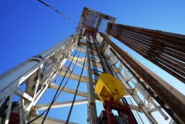
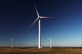
Oil and Gas
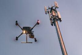
Telecommunications
Inspections
Surveys / Mapping
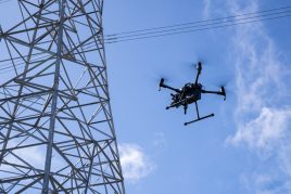
Energy
Environment
Property
Insurance
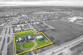
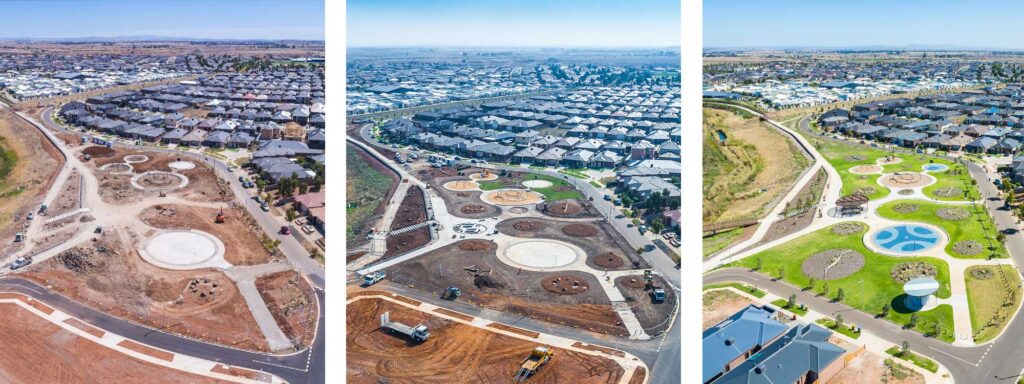
Construction Progress
CONSTRUCTION | REAL ESTATE | INFRASTRUCTURE
Aerial time-lapse.
Through our latest drone technology and software, UAVisuals are also able to reconstruct the site as a 3D model over time creating the most impressive visual display for your clients.
Working at dangerous heights and areas to inspect assets such as machinery, pipelines, flare stacks creates complex challenges in terms of OH&S and possible operation downtime.
Our drones carry high-resolution cameras whilst hovering in close proximity to inaccessible areas for inspection. By doing this we are able to keep your workmen safe and on the ground. These drones can be launched within minutes and fly direct to the area of interest. Our technology also enables us to provide your team with a live HD video feed to the operator or to any office.
Key Benefits:
Cost Reductions – An inspection while the asset is still online will save you up to 60% of valuable production time and money.
Minimal Health & Safety issues– Our small, light, unmanned, battery-operated UAVs reduce the need for personnel to be placed in dangerous situations
Minimal Risk– Keep personnel and machinery safe with low risk whilst working in dangerous areas.
No Shutdowns– Plants, rigs, flare stacks are able to stay online and operational during inspections
Higher quality information – Our Pilot skills together with using cutting-edge technology allows a high quality of data and diagnosis within minutes
Eliminate working at heights with remote inspections.
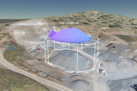
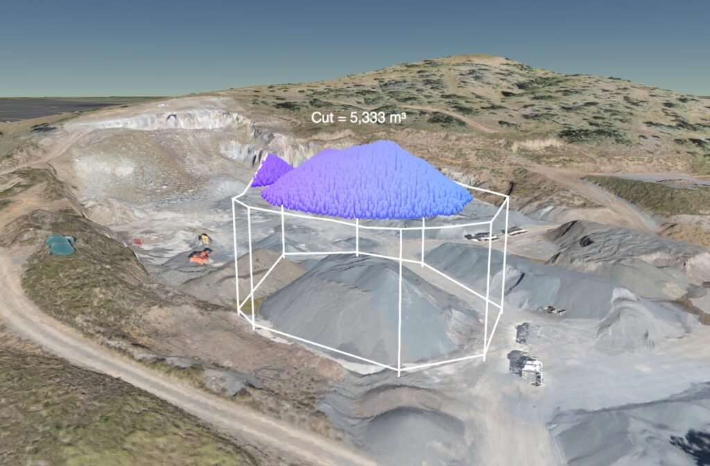
Mapping & Surveying
2D | 3D | VOLUME ESTIMATES
UAVs have the ability to create high resolution and accurate imagery for mapping and land surveying.
UAVisuals can mobilise and be in the air within minutes of arriving on site and provide you with a user-friendly interface in a just a matter of hours!
The aerial imagery is geo referenced and ortho-rectified with extreme accuracy, meaning measurements can be taken directly from the drone images. Measurements such as area, distance, volume calculations and elevation models.
Our systems are programmed to fly in an pre-programmed path, perfect for time-lapse analysis for industries like construction, commercial real estate and more
Determine stockpile volume estimates
“When drone mapping and the gaming world come together”
Read how our drones were used in the latest MotorGP video game
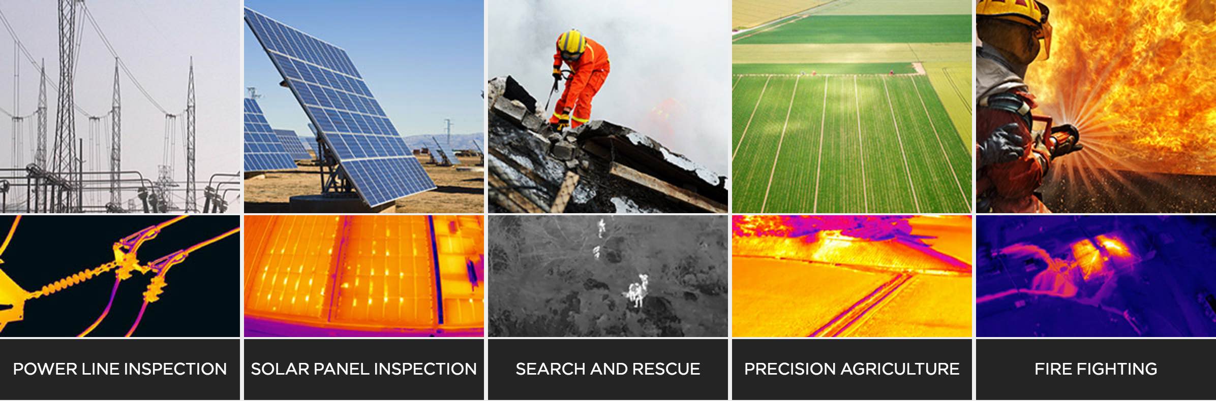
See what the eye can’t see. It’s no secret about thermal technology, however a thermal camera on a drone with has become an invaluable tool. Weather it’s inspecting a flare stack, or solar panel for pixel sized temperature variations or on a large-scale area for precision crop analysis.
Utilising the latest Flir thermal micro cameras combined with a range of flying platforms, UAVisuals can capture high-resolution thermal video and full colour images simultaneously. Our thermal inspection equipment is stabilised by a cinema-grade brushless gimbal.
Ideal for infrastructure and process plant inspections our drone-based systems simplify the inspection process giving you quality data at low costs.
Inspection reporting is available post flight with spot measurements of hot/cold points of interest. Our drone systems allow you to frequently inspect inaccessible and dangerous areas without compromising safety to personnel. Looking for Drone Videos?
Applications
*Image courtesy of Flir & DJI
UAVISUALS® GROUP is a premier Australian drone-based services & data solutions company operating throughout Australia. We offer a national service and consulting servicing a range of industries utilising cutting-edge drone tech.
Our knowledge and passion for the industry ensuresa we can deliver the best results for your business.